Last port of call
Half full of jute from Chalna we were now approaching
Trincomalee on the east coast of Ceylon to fill up with tea. This could be
exciting.
Outward bound we had been in Colombo for a few weeks, both
at anchor waiting a berth and then in port. It had been one of the most
enjoyable port visits on the voyage, not least because of the opportunity to
meet people ashore especially good-looking girls in the swimming club.

The immaculately dressed naval pilot arrived even wearing
white gloves, now a little soiled after climbing the pilot ladder to be greeted
by our Captain who, surprisingly was also immaculate. Not an aertex singlet to
be seen!
Well, Captain, we are taking you to an anchorage so you can
load tea directly from barges. This did not sound too good, no shore leave,
well well.
We anchored in a large bay with a sandy beach behind which
was a tropical jungle where even with the naked eye you could see monkeys
jumping in the trees.
There is a club on the beach, said the pilot, that is
available to you to relax whilst you are loading. This sounded a lot better, I
thought. Who knows who we will meet.
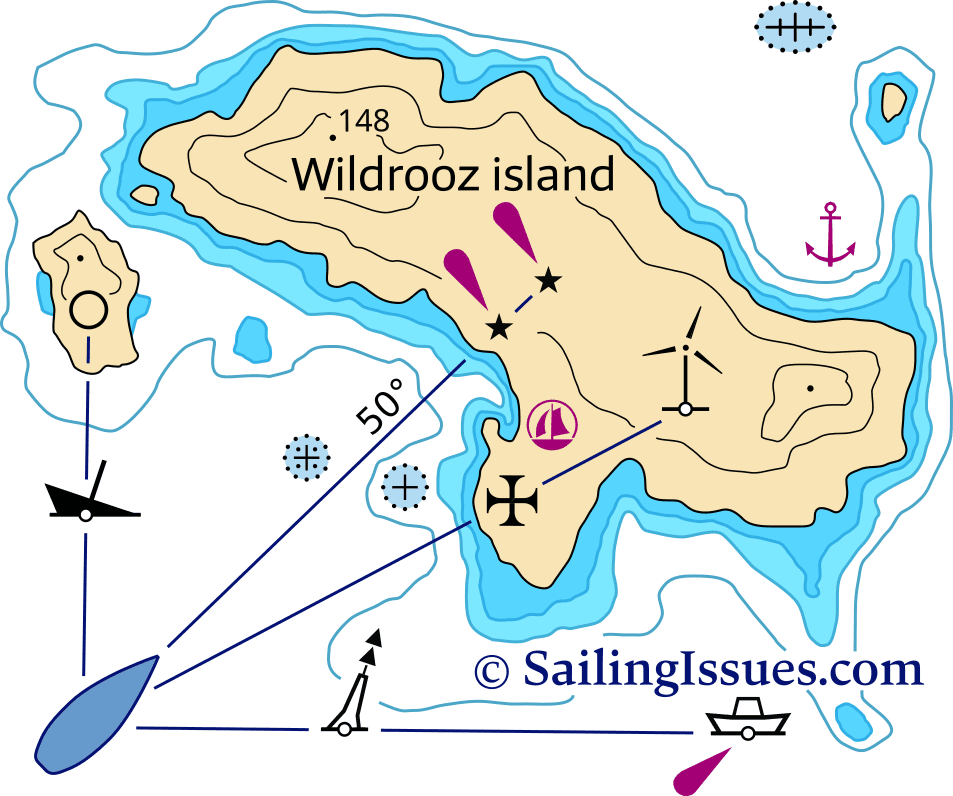
[2]A
transit bearing is when two fixed objects are in line. They will have a transit
bearing only when they are in line. So we need to search for such objects now
that we are stationery at anchor. They need to be visible day and night to the
naked eye and fixed on the chart. We need at least two, better three such
transit bearings to fix our position. We also need to keep in mind that the
vessel swings with the tide and there can be some variation in the chosen
bearings. Only experience will tell you whether it is because of the ship
swinging with the tide or that we are dragging our anchor. That will keep you
on your toes on the night watch!
So we searched around the coast and found some good
transits, church spires with prominent hills, lit buoys with lighthouses, all
on the chart.
OK, draw them on the chart and note the bearing and then
check with the gyro bearing compass and report back. Dutifully did that and
then came the examination! Was there a difference between the bearing on the
chart and that you took with the gyro compass. Yes, I replied. OK why is that
Jock pressed me for an answer. Luckily, I had spent some time with my
correspondence course which normally was incomprehensible to me but on coastal
navigation I seemed to grasp it.

So started a couple of weeks whilst barges came and went and loaded chest after chest of tea whose fragrance pervaded the whole ship. Best of all we were put on night anchor watches and mine was midnight to 06:00 leaving me free in the afternoons. This a dream job, very little to do on night anchor watch, hanging over the wing of the bridge to catch what little wind there was and check the transit bearings from time to time. A little anxious when we swung with the tide as the transit bearings came out of line a little. Were we dragging anchor or was it just the natural catenary of the anchor chain changing position. Apart from that I just dreamed of those girls at the Colombo swimming club. What lucky chap was chatting them up now whilst I was stuck at the other side of the country!
The Chief officer said we would put the motor lifeboat in the water for runs ashore and to teach the apprentices small boat handling. This was going to be fun. Of the four lifeboats we had only one had an engine and this was lowered from its stowed position to the embarkation point on the boat deck and we

scrambled in. Once in the water the chief officer decided a run ashore to the club on the beach would be an excellent introduction to small boat seamanship. You need to know that the lifeboat was like a giant bathtub and handled like one so manoeuvring was not easy but slowly we mastered the basic actions and were rewarded by a beer on the veranda of this club that seemed remarkably deserted except for the hundreds of monkeys racing through the trees.
Far too soon the hatches were battened down and chippy
started wedging the hatch covers and the tea exporter gave us all a small tea
chest of orange pekoe tea and we left that lovely harbour and started our
voyage back over the Indian Ocean to Aden.
The southern tip of Ceylon is renowned fishing grounds, so
we needed to keep a good lookout for the small wooden outrigger boats that
fished well offshore and were difficult to spot especially at night as not all
of them displayed any sort of light.
This area is also known for the concentration of whale
sharks especially in February and March and they are slow swimmers so avoiding
them is imperative. So visual lookout was a prime job for us junior
apprentices.
Once we cleared Ceylon and entered the Indian Ocean, Jock
turned to me and with a broad smile and said, now laddie we have 10 days of
ocean voyage in relatively calm seas, time for you to start learning Celestial
Navigation. I was dreading this as quite apart from the practical work of using
a sextant that I felt competent at, the notion of mathematics and trigonometry
left me quite numb. I was bottom of the bottom class in my year at school for
three years running for maths. All those X’s and Y’s and negative numbers meant
nothing to me!
Let us keep it simple and concentrate on the “noon sight” to
find latitude and longitude. You do know what latitude and longitude is? You
have used them on the chart so what if we do not have any coast, only sea and
need to find our position?
So we have the sun, and we know it rises in the east and
sets in the west every day. At a precise time every day it reaches its zenith,
its highest altitude. This time we will call local noon for wherever we are.
Greenwich in the UK is the prime meridian where longitude is zero degrees, and
the time zone is called GMT (Greenwich Mean Time).
Now we know the earth rotates 360 degrees in 24 hours, one
day. So that means it moves at 360/24= 15 degrees of longitude per hour. How
can this help us? With an accurate clock, that’s how and we have two
chronometers thanks to [5]John
Harrison, a Yorkshireman in 1730. He invented a clock that could keep accurate
time even at sea with all the movement of the ship. We have two and we check
their accuracy every day against the “Greenwich radio pips” and note any error.
They are adjusted to keep Greenwich time wherever we are in the world. Savvy so
far?
So we get an accurate chronometer time for the time the sun
is at its zenith for our position. We then use our Nories Nautical tables to
find the time the sun reached its zenith at Greenwich, the prime meridian (0
degrees). So now we have the times for noon at Greenwich and for our position.
The difference between them is converted to longitude at 15 degrees per hour to
give us our approximate longitude. It is only approximate because it is
difficult to measure the exact altitude for the zenith as the sun moves ever so
slowly as it passes through noon. Nevertheless it can be accurate within 15
nautical miles, enough out in the ocean.
So now we need to calculate latitude for the same time. We
can do this with our noon sight also. The altitude of the sun at its zenith
means it is on our meridian of longitude, due south or north, and it becomes
relatively easy to measure its declination. The suns declination is the angular
distance of the sun north or south of the equator and we can read its value from
our nautical tables for precisely this time. You will remember that the sun
wanders north and south in the year because of its tilt axis between the winter
solstice when there is the shortest day and the summer solstice when there is
the longest day in summer. We need to know the angular distance when the sun is
directly overhead, the zenith distance. This is simply 90 degrees minus our
observed altitude. Latitude is then a matter of arithmetic.

If the declination and approximate latitude are in the same hemisphere and the latitude is greater than the declination, we add the zenith distance to the declination. For the same hemisphere if latitude is less than declination, we subtract the declination from the zenith distance. If latitude and declination have different names, we subtract declination from the zenith distance.
OK, I see your eyes are glazing over so enough for now but
every noon sight you can calculate our approximate position alongside us.
Go and find our approximate position from the start to be
sure what hemisphere we are in and find the declination for today from your
pristine new [6]Nories
tables. Also find the table for converting time to longitude and the time of
meridian passage at Greenwich.
Steaming northwest across the Indian Ocean you also cross a much older traditional trading route between Africa and the Arabian Gulf and we often saw sea-going dhows on passage. A refreshing sight.

References
‘Bossoir_a_gravité.Jpg (960×1280)’. Accessed 9 April 2023.
https://upload.wikimedia.org/wikipedia/commons/7/77/Bossoir_a_gravit%C3%A9.jpg.
‘Chronometer Watch’. In Wikipedia,
10 August 2022.
https://en.wikipedia.org/w/index.php?title=Chronometer_watch&oldid=1103608912.
‘OLD EDITION Norie’s Nautical Tables’.
Accessed 19 April 2023.
https://www.imray.com/product/old-edition-nories-nautical-tables/ib0095-1/.
Small crates and tea chests. ‘Small
Crates and Tea Chests’. Accessed 8 April 2023.
https://farthinglayouts.blogspot.com/2015/04/small-crates-and-tea-chests.html.
‘Transit Bearings - Google Search’.
Accessed 7 April 2023.
https://www.google.com/search?q=transit+bearings&tbm=isch&chips=q:transit+bearing,g_1:navigation:4C6g_BECbgg%3D&hl=en&sa=X&ved=2ahUKEwiAzo_835f-AhWWxyoKHWWvDpkQ4lYoAHoECAEQJg&biw=1501&bih=686#imgrc=HEjzrQFdswtcsM.
‘Trincomalee: India’s Call’, 27 April
2017. https://www.vifindia.org/article/2017/april/27/trincomalee-india-s-call.
[1] ‘Trincomalee: India’s Call’, 27 April
2017, https://www.vifindia.org/article/2017/april/27/trincomalee-india-s-call.
[2] ‘Transit Bearings - Google Search’,
accessed 7 April 2023, https://www.google.com/search?q=transit+bearings&tbm=isch&chips=q:transit+bearing,g_1:navigation:4C6g_BECbgg%3D&hl=en&sa=X&ved=2ahUKEwiAzo_835f-AhWWxyoKHWWvDpkQ4lYoAHoECAEQJg&biw=1501&bih=686#imgrc=HEjzrQFdswtcsM.
[3] ‘Small Crates and Tea Chests’, Small
Crates and Tea Chests (blog), accessed 8 April 2023,
https://farthinglayouts.blogspot.com/2015/04/small-crates-and-tea-chests.html.
[4] ‘Bossoir_a_gravité.Jpg (960×1280)’,
accessed 9 April 2023, https://upload.wikimedia.org/wikipedia/commons/7/77/Bossoir_a_gravit%C3%A9.jpg.
[5] ‘Chronometer Watch’, in Wikipedia,
10 August 2022,
https://en.wikipedia.org/w/index.php?title=Chronometer_watch&oldid=1103608912.
[6] ‘OLD EDITION Norie’s Nautical Tables’,
accessed 19 April 2023,
https://www.imray.com/product/old-edition-nories-nautical-tables/ib0095-1/.


Very complicated navigation lesson
ReplyDeleteyes, perhaps a little too much!
ReplyDelete